
|
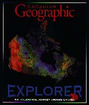
The Canadian Geographic Explorer.
Toronto, ON: IQ Media Holdings, 1996.
Grades 5 and up / Ages 10 and up.
|
To run the CD-ROM program Canadian Geographic Explorer, the following are required:
|
PC
486 DX 33 256 Colour Monitor 2X CD-ROM Drive Sound blaster or equivalent Windows 3.1 8 Mb RAM |
Macintosh 68040 Colour Monitor 2X CD-ROM Drive System 7 8 Mb RAM |
 The program that I used included a 24 page "User's manual," 1 pair of
3-D glasses, the CD and a "Dictionary for Children." There is a Lab
Pack with Site License for $295.00 or a Teacher's Pack for $125.00 or
a Single CD-ROM Pack (what I had) for $64.95. Canada's landforms,
natural environments, cultural mosaic, size and beauty are explored
using 3-D satellite images, over 500,000 map combinations, map-making
tools, terrain-simulated flights, full-motion video, remote-sensing
imagery, astronaut video and narration plus archival material from
Canadian Geographic. The subjects of science and geography
are integrated throughout the CD-ROM.
The program that I used included a 24 page "User's manual," 1 pair of
3-D glasses, the CD and a "Dictionary for Children." There is a Lab
Pack with Site License for $295.00 or a Teacher's Pack for $125.00 or
a Single CD-ROM Pack (what I had) for $64.95. Canada's landforms,
natural environments, cultural mosaic, size and beauty are explored
using 3-D satellite images, over 500,000 map combinations, map-making
tools, terrain-simulated flights, full-motion video, remote-sensing
imagery, astronaut video and narration plus archival material from
Canadian Geographic. The subjects of science and geography
are integrated throughout the CD-ROM.
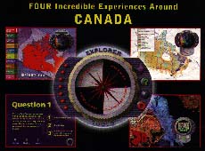
As a novice in using such programs, I found it to be quite user friendly. The icons are easy to read, and the directions are clear. However, as you proceed through the interactive, multimedia program, there is one glaring omission. Ten male astronauts are introduced, and they relate valuable information about Space, but no women are included. There is no acknowledgment of Roberta Bondar and her contributions to the Space Program.
Students from Grade 5 and up would be able to use this program. Drawing provincial lines on the outline map of Canada, figuring out distances between cities, labelling capital cities and physical regions are just four activities that would assist students in better knowing their country.
In the "Compareography" section of the program, the words that are used would be difficult to handle for most average students. The use of terms like "Compareography," while cute, are out of place in a serious program intended to impart information. Students may come away thinking that such words are acceptable vocabulary. Students are given ten choices for comparison, and "Help" is accessible if problems arise. The pictures on the side of the screen in this section are there for decoration only. In my opinion, they should get larger and open with more information being given.
In the "Map maker" section, the fact that any map that is drawn can be printed is a bonus for evaluating what the students are learning. In general, I think that this program would be worthwhile for schools to own.
Recommended.
Gary Evans is a grade two teacher at McDowell School in St. Vital School Division, Winnipeg, MB, and a sessional Social Studies Instructor at the Faculty of Education, the University of Manitoba.
To comment on this title or this review, send mail to cm@umanitoba.ca.
Copyright © 1998 the Manitoba Library Association. Reproduction for personal use is permitted only if this copyright notice is maintained. Any other reproduction is prohibited without permission.
Published by
The Manitoba Library Association
ISSN 1201-9364
TABLE OF CONTENTS FOR THIS ISSUE - JANUARY 16, 1998.
AUTHORS | TITLES | MEDIA REVIEWS | BOOKSHELF | BACK ISSUES | SEARCH | CMARCHIVE | HOME