| ________________
CM . . .
. Volume XIX Number 6 . . . . October 12, 2012
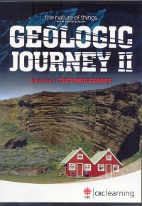
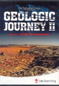
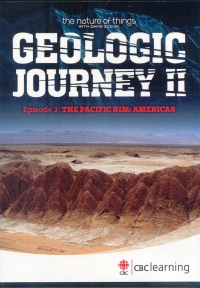
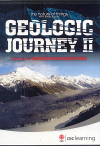
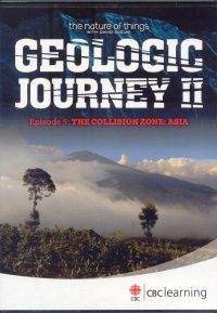
Mountains are often used as symbols of permanence. Having two feet on solid ground is a good thing. However, after viewing Geologic Journey II, where the Earth’s volatility and movement are featured, one might want to shy away from any Earth imagery as a basis for stability. Geology Professor Nick Eyles travels to Europe, Africa, The Pacific Rim, and Asia to show how much power exists below the Earth’s surface and what happens when this power shows itself in the form of earthquakes and volcanoes. The enthusiasm he shows during his travels is infectious. Clearly he finds the Earth fascinating and wants to share that with the viewer. Geologic Journey II uses stunning photography to show the beauty of the Earth. The viewer is taken over majestic mountains and landscapes. Graphic scenes show what happens when the Earth shakes or lets off some steam. Computer graphics present what is happening beneath the Earth’s surface and are used to explain how present formations came to be. Computer renderings are used to show the ongoing (albeit slow) formation of new oceans and land masses. Originally shown on The Nature of Things, Geologic Journey II is narrated by David Suzuki and is made up of five episodes. Each segment features a particular area of activity. While the episodes have a common theme, the series need not be viewed in order or in its entirety as each episode summarizes what is needed from previous episodes. Each is structured in chapters which would allow for pausing and discussion in a class. The presentation is dynamic with powerful soundtracks and beautiful photography. Geologic Journey II does much more than show geologic activity. People have been living in these active areas for centuries. The films connect the Earth’s movement to local history, customs, and religious beliefs. In each episode, local scientists and residents are interviewed. As a result, the films have applicability in a wide variety of subject areas: Sociology, Anthropology, Religion, Geography, History, Science, Photography, Video production, Career Studies, and, of course, Geology. Included with the set is a Teacher Resource Guide which features detailed lesson plans for each of the episodes. Background material, activities, line drawings, maps, further information and web links are provided. “CBC Learning authorizes the reproduction of material contained in this …Guide for educational purposes. Please identify and credit the source.” Geologic Journey II will shake up the way anyone looks at the Earth. The idea that mountains are simply the ocean floor thrust up by colliding plates is truly mind-boggling. Earthquakes, volcanic activity, tsunamis, landslides, tremors, flooding—all show that the idea of “solid ground” may be a classic case of ignorance being bliss. Much of the world is in constant movement. After one views Geologic Journey II, ignorance may be transformed to fear and awe, but one cannot help but be moved by the power and beauty. Geologic Journey II: Episode 1: Tectonic Europe. Geology Professor, Dr. Nick Eyles discovered that, when talking about geology simply in terms of rocks and minerals, his students were not particularly engaged. He would much rather present geology as the Earth in constant motion and show how this is manifested throughout the world. This is the central idea behind Geologic Journey II, a series of films which look at the Earth from a geological point of view and show how geology is central to everyone. Tectonic Europe, the first of five episodes, looks at the movement of the tectonic plates in Iceland, Scotland, England and the Alps. While the Earth is in constant flux and motion, people are still surprised by visible proof, especially in the form of volcanoes. Given Iceland’s particular position straddling the European Plate and the North American Plate, one cannot avoid seeing the Earth’s activity. Volcanoes, hot springs, lava fields, open boiling mud pools—all show what is normally hidden beneath the Earth’s surface. Iceland is in a precarious situation as shown by the recent eruption of Eyjafjallajökull. While such occurrences show the power and potential danger, Icelanders have managed to take advantage of geothermal activity for power and heat. The use of computer graphics allows a rendering of how the plates are interacting. Considering they are moving apart at the “speed of fingernails growing”, the graphics help speed up the passage of time. In Scotland, Eyles praises the work of James Hutton who is seen to be to the study of Geology what Darwin is to Biology. Hutton, while religious, did not accept the church explanation that all land forms were the product of the Great Flood. And while the date of the Earth’s formation was calculated as happening on a Sunday four thousand years earlier, Hutton saw that the patterns in the mountains around him could only be formed by pressure, heat and time. For this reason alone, the Earth had to be older than speculated. The area of Hadrian’s Wall shows where England and Scotland were formed together out of two distinct land masses. Fossils in the rock also assist in dating the rock formations so “the layers of rock are like the pages of the book of Earth history.” To the south of England, the crumpled look of the coastline shows that the African Plate is moving north and is causing the rock to fold. The African Plate’s movement is also seen in the Alps. These mountains are actually the ocean floor pushed up by the on-going collision of the European Plate and the African Plate. According to Eyles, the largest mountain in the Alps is actually a piece of the African Plate that has been pushed up. “Pillow basalt”, which occurs on the ocean floor when lava comes in contact with ocean water, appears in the mountain rock. Much of the information in the film would be unbelievable if the proof was not provided. Eyles wants to show that, when presented with proof that the Earth is still in formation, one cannot help but be impressed. He has succeeded. Tectonic Europe is beautifully filmed. The images, one after another, are stunning as the viewer is shown vistas, mountain tops and waterfalls, in truly a birds’ eye view perspective. Interviews with local geologists show that the study of “rocks and minerals” has applications to much of what we take for granted or simply do not know. Highly recommended for any senior class studying the Earth: Geology, Geography, Physics, Photography. The presentation is fast-paced and could be shown in a regular class. Because this episode is divided into six chapters, the film does not have to be viewed in one sitting. Added bonus: As this series is part of The Nature of Things, Episode One features a discussion between David Suzuki and Eyles. Here, they talk about the relevance of studying Geology. Eyles is clearly animated by his subject area, and this is seen throughout the series. He is an engaging host and states that Geology has to be “people-focussed”. The series could be used as a recruitment film for Geology as a career path. Geologic Journey II: Episode 2: Along the African Rift. Along the African Rift is the second in the Geologic Journey II series where Geology Professor Nick Eyles continues to show how active this planet Earth actually is. Here, he travels to the Rift Valley in Africa. Stretching from Mozambique to Turkey, the Rift Valley is the story of the birth and death of an ocean. As “its ash layers entomb much of our ancient history”, there is information here for geologists as well as anthropologists. The Rift Valley is “largest tear in any plate on the planet.” Things happened here that have happened nowhere else. Because the rift continues to grow, “geology is happening before one’s eyes.” The African Plate and the Somalian Plate are being pushed apart, and “in 10 million years, the valley will become an ocean.” Computer generated animation shows how this will happen. From an historical point of view, this area contains the rise and fall of civilizations. The claim can be made that “the Rift became the catalyst for human evolution.” It was a centre of salt production for centuries. At times, “1000 camels per day carried salt away.” The Nile River begins here. The cycle of river flooding was reflected in records of a high tax year as the floods provided fertile soil for farmers. The local sandstone allowed for the development of hieroglyphics. Rocks, therefore, “became a means of immortality”—in story telling as well as the building of monuments. Petra, a trade capital 2000 years ago, was destroyed by an earthquake in 363 A.D. and then abandoned in 500. Using the fallen buildings, geologists are able to study the earthquake’s impact. In Israel, the Dead Sea Rift is pulling apart, and the Dead Sea, itself, is shrinking. The fallen walls of Masada show the impact of an earthquake in 31 A.D. As with all areas where the plates meet, the Rift Valley has been affected by earthquake activity throughout the past and, according to the film, will be impacted again. As in Episode 1, this geological study is beautifully filmed and provides a wealth of information. Eyles shows the volatility of the Earth and how civilization has managed to adapt to the fact that nothing stays the same. For this reason, Along the African Rift could be used in a Geography, History, Anthropology and, of course, Geology class. At under an hour and divided into chapters, the film could be shown in sections or in its entirety. Geologic Journey II: Episode 3: The Pacific Rim: Americas. The Pacific Rim: Americas, Episode 3 of Geologic Journey II, looks at the eastern Pacific Rim which stretches from Alaska to Chile. Here, the Pacific Plate is colliding with the North American Plate and is creating some of the fastest growing mountains in the world. Geology Professor Nick Eyles continues his presentation of the movement of the Earth and the need to know that much of the world is in geologic flux. One manifestation of the plate activity is the frequency of earthquakes. In 1964, Alaska was hit by the largest recorded earthquake in North America. Houses were taken out to sea; others were buried in landslides. The ground under Anchorage turned to quicksand, and its downtown sank in minutes. The earthquakes, followed by tsunamis and resulting high tides, destroyed many communities along the coast. As the mountains rise up, glaciers grind them down and send rock and debris down the mountainside. The rocks in Icy Bay, Alaska, have come from somewhere else—some as far as 100 kilometres. As global warming speeds up the melting of the glaciers, moraines of rock stretch for tens of kilometres. Further south, the San Andreas Fault, a gash in the plate, stretches from California to Mexico. While this area is fertile and excellent for the wine industry, there is evidence that the ground is not stable. One winery reports five earthquakes a day—all minor, but a reminder of the earth’s activity below. Foundations of buildings show cracks, and the walls have moved 15 inches in 50 years. The San Andreas Fault runs right through San Francisco. In fact, the stadium in Oakley is built directly on the San Andreas Fault. Cracks in the walls are many, and braces have been installed on the buildings. The 1906 San Francisco Earthquake killed over 3000 people. While it started off shore, waves hit the city immediately. Today, one can see the shift in the earth as second storey windows are at ground level, and what was once ground level is below. Residents remain fatalistic about the chances of another earthquake. As the city is actually on six faults, the likelihood of another earthquake happening within 30 years is 60 percent. Chile, with its 1000 kilometre coastline, is one of the most earthquake prone places on the planet. An earthquake in 1960 sent a tsunami right across the Pacific. Between the Andes and the Pacific Ocean lies the Atacama Desert—one of the driest places on Earth. Once, it was a place of lakes and trees. All that remains are the salt beds and large copper deposits. Here, the Nazca Plate is going under the South American Plate and forming the Andes. The forces of these plates colliding are seen in the many volcanoes. The local residents are aware of the volatility of the Earth, and their rituals contain appeals to the forces of nature to remain calm. In Patagonia, while the landscape is more lush and beautiful, the ground below is no less active. The town of Chaitur was caught off guard by a volcano the people thought was dormant. It was low to the ground, hidden by vegetation and showed no evidence of activity. However, in 2008, the town was covered by 15 to 30 metres of wet volcanic ash. The mud flow blocked the local river and flooded the town centre. While the volcano is still active, the inhabitants do not wish to leave. Chile has over 100 active volcanoes, and so this story will be replayed a number of times. Pacific Rim: Americas shows that, while the dangers of living in such volatile areas are clear, people are not eager to vacate. Volcanic ash is fertile, flooded areas become good growing areas, and landslides leave the mountainside less severe and can be farmed. When calm, the land is beautiful. Alaska is actually growing in size with each earthquake. Scientists still have not found a way to predict exactly when an earthquake will happen or a volcano will erupt. However, they do agree that something will happen. This film continues with the beautiful photography of past episodes and computer graphics to show the plates in action. Film footage of the past earthquakes is included as are interviews with the people most affected by the Earth’s activity. Pacific Rim: Americas would be valuable in Geography. History, Anthropology, Psychology, Sociology and, of course, Geology. Geologic Journey II: Episode 4: The Western Pacific Rim. The Pacific Rim: Americas, Episode 3 of Geologic Journey II, featured the activity on the east side of the Pacific Rim. In Episode 4, The Western Pacific Rim is presented as being no less active. Stretching from New Zealand to Japan, this area is in constant threat of catastrophe. Geologically speaking, New Zealand is a relative late-comer. In time, the scattered islands will become one land mass. Here, the activity is caused by the meeting of the Australian Plate and the Pacific Plate. Scientists are monitoring White Island, an active volcano, daily to learn about the nature of its volatility. This science is fairly new, and there is much that needs to be learned. In 1886, Mount Tarawera erupted and buried the landscape in a blanket of pulverized rock and incinerated everything around it. Maori legends tell of a god who gave the gift of land from the ocean. New Zealand’s volcanic activity is due to the fact that, despite its lush and beautiful landscape, it is situated on a network of hidden faults. An earthquake in Wellington in 1942 demolished every chimney in the city. Each earthquake pushes rock up from the sea bed. The visible rocks of today were once on the ocean bottom. One scientist interviewed states that there will be an earthquake, but he cannot predict if it will be a hundred years from now, or tomorrow. In Japan, the possibility of an earthquake is a given. Situated on the Pacific and Philippine Plates and the Eurasian and North American Plates, Japan is on a “four plate pile up”. Children practice earthquake drills in anticipation of the real thing. When Tokyo was hit by an earthquake in 1923, 142,000 people were killed. The people in the city of Fukuroi thought they were being bombed in 1944 when, in reality, it was an earthquake. The local school was buried in debris, and many children were killed. The film gathers a number of survivors to talk about their experiences. All these years later, emotions are still very raw when they talk about that day. Mount Fuji, Japan’s national icon, has been quiet, but this has not always been so. In 1891, 7000 people were killed when a fault opened and the land dropped six metres. A parade to honour the Goddess of the Mountain is part of the Shinto tradition as a replica of the Goddess and of the mountain are taken through the streets. Fire ceremonies also honour her as the people hope to appease her and stave off any more eruptions. The film shows off-shore research that is going on in an attempt to more accurately predict when earthquakes will take place. If measuring temperatures and pressures prove to be accurate, the work here will revolutionize earthquake sciences. On New Zealand’s south island, the Pacific Plate is meeting the Australian Plate. The resulting Southern Alps show the ongoing geological activity. The plates collide and form mountains which are growing 10 millimetres per year. These are being ground down by the glaciers, and the debris is carried back toward sea level by rivers. The cycle continues. The Western Pacific Rim, like past episodes, is a wonder to watch. The landscapes are magnificent from above and shockingly active below. Beautiful photography and computer graphics combine to present what is visible and what is expected. The film has applicability in any class dealing with Geography, History, Religion, Science and, of course, Geology. Geologic Journey II: Episode 5: The Collision Zone: Asia. In The Collision Zone: Asia, the fifth and final episode of Geologic Journey II, Geology Professor Nick Eyles’ presentation begins in the Himalayas and runs to the mouth of the Ganges River, a journey of 2500 kilometres which impacts one billion people. Long ago, the Indian land mass collided with the Asia land mass, and, in doing so, the Himalaya Mountains were formed. These majestic mountains have taken on a very spiritual place for the local people. Demons and spirits live in the rocks and are the cause of the activity in the mountains. Earthquakes and landslides have been devastating. These are seen as signs of disharmony. For this reason, many temples exist in landslide areas. Pilgrimages to sacred sites are many. Rituals exist to keep the earth calm. Fossils found on the mountains (which have been discussed in previous episodes as coming from the sea bed) are revered. Here, the film moves away from the science of Geology and shows how the local people see nature in terms of spirituality. A major aspect in worship is the importance of water. Water from the mountains is seen as pure and essential for cleansing before approaching the temple. The geologists see this water as glacial melt and not so pure with the impact of global warming. The melt is happening more quickly, and, as a result, more silt is being washed downstream. The silt causes problems for hydro-electric generators, and excessive build up of silt can alter river flows. The sacred water flows through Nepal’s capital, Kathmandu, which is growing very rapidly without a plan. Situated on a former lake bed, it is in an earthquake zone. Children routinely go through earthquake drills, but concern is stated that, if an earthquake were to happen, the city would be ill-prepared to deal with it. While the river provides fertile farm land, the strain of so many people newly arriving is enormous. Further down river in Calcutta, the sacred water is sought after by the devout. Bathing in the Ganges is essential. However, with sediment and pollution, the waters are no longer pure. Freighters stir up the silt and further pollute the river. Skin rashes are common. One scientist interviewed acknowledged the discrepancy between Science and Religion. He knows the water is polluted, but he also knows that it is sacred. The silt deposits at the mouth of the Ganges form islands which are growing. As they get larger, people move on to them. However, because they are at sea level, they are in danger of flooding. The cycle is completed here. The seabed is pushed up as mountains and then is eroded and flows back to the sea. As the plates continue to push against each other and new land masses are formed, in 200 million years one “super continent” will be formed. In the meantime, the process continues. Collision Zone Asia, while as beautifully filmed as the previous episodes, spends more time on the connection of the land and the people. The differing views of what makes the mountains move would be an interesting discussion topic in a Religion or Philosophy class. The importance of water and the need for keeping it pure certainly applies in a Geography or Ecology class. There is much in this film for an Anthropology, Sociology, Current Issues and, of course, Geology and Science classes. Some of the information in the film is a review of what has been discussed in past episodes, but it would not be seen as such if viewed independently. Highly Recommended. Frank Loreto is a teacher-librarian at St. Thomas Aquinas Secondary School in Brampton, ON.
To comment on this
title or this review, send mail to cm@umanitoba.ca.
Copyright © the Manitoba Library Association. Reproduction for personal
use is permitted only if this copyright notice is maintained. Any
other reproduction is prohibited without permission.
NEXT REVIEW |
TABLE OF CONTENTS FOR THIS ISSUE
- October 12, 2012.
AUTHORS
| TITLES | MEDIA REVIEWS
| PROFILES
| BACK ISSUES
| SEARCH | CMARCHIVE
| HOME |
