| ________________
CM . . .
. Volume XVIII Number 13. . . .November 25, 2011 
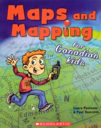 |
Maps and Mapping for Canadian Kids.
Laura Peetoom & Paul Heersink.
Toronto, ON: Scholastic Canada, 2011.
38 pp., pbk., $7.99.
ISBN 978-1-4431-0493-7.
Subject Headings:
Map reading-Canada-Juvenile literature.
Maps-Juvenile literature.
Cartography-Juvenile literature.
Grades 2-5 / Ages 7-10.
Review by Barbara McMillan.
**** /4
|
| |
|
excerpt:
A map is a picture of a place, but not like a painting or a photograph, which shows us what a place looks like. A map is a picture of information about a place. (p. 4)
The earliest known maps of Canada were drawn by seafaring explorers from Europe. Our whole continent was a surprise to them. When they found it, they were looking for something else – an easy passage to India and China. So early maps of North America highlight information useful to readers looking for a way through: the shape of coastlines, the location of waterways and how far they travelled into the land. (p. 14)
The word "map" comes from the Latin word 'mappa,' meaning cloth. In earlier times, maps were drawn on animal skin or cloth. "Cartography" was borrowed from French: 'cartographie' means "map drawing." (p. 16)
I suspect many children first see maps on family trips, however near or far, but that their first meaningful encounter with maps occurs in fiction. This could be with star maps or treasure maps where X marks the spot, weathered maps of a kingdom or maps that look more like works of art than how to locate a place or find one's way. Whatever the case, maps can be appealing and fascinating. Authors Laura Peetoom and Paul Heersink capture this emotional response when they write: "maps shrink the world" (p. 7); "maps are inspiring: there's nothing like reading a map that makes you want to get out and explore!" (p. 2) They invite readers to think more deeply about maps, why they were and continue to be made, and how map making changed with the invention of paper, the compass, cardinal points, chronometers and, more recently, satellites, global positioning systems, and computer technologies.
Maps and Mapping for Canadian Kids begins with an engaging two-page introduction that quickly moves into a definition of what maps are and a description of their basic features (i.e., scale, symbols, and colour). Readers learn about overhead and oblique views, proportion, legends, and the meaning of the contour lines on topographic maps. They also read that world maps require at least five colours. In this way, a country is never next to another country of the same colour - an idea that calls out for first-hand investigation.
With this basic information presented, Peetoom and Heersink introduce historical maps of Canada. They acknowledge the importance of the knowledge and place names of First Nations peoples and include an 1841 map on birch bark of a canoe route from the Mattawa-Ottawa River systems to Lake Nippissing-Lake Huron. The next 12 pages of the book are focused on orientation and navigation and the tools and information that have made this possible on land and water. Readers learn about latitude and longitude, co-ordinates, geocaching with a GPS unit and how a GPS determines its location. They also learn about the cartographer David Thompson (1770-1857), his interpreter Charlotte Small, and surveying. This is followed by the suggestion that readers make their own maps. The steps for doing so are provided as well as a rationale: "The more we know about a place, the more important a good map becomes" (p. 37).
Don't let the comic book style cover fool you. Maps and Mapping for Canadian Kids is well illustrated with stockphotos. Red, blue and purple map pins are used respectively as bulleted points, to hold page numbers, and to identify text boxes with factual information. In addition to making a map, Peetoom and Heersink have included two uncomplicated and familiar activities readers are encouraged to try. One is to locate Polaris in the night sky. The other is to make a compass using a magnetized needle, a cork or Styrofoam disk, and a shallow dish of water. The book begins with a well-organized table of contents and concludes with a well-considered glossary of terms.
Highly Recommended.
Barbara McMillan is a teacher educator and a professor of science education in the Faculty of Education, the University of Manitoba.
To comment
on this title or this review, send mail to cm@umanitoba.ca.
Copyright © the Manitoba Library Association. Reproduction for personal
use is permitted only if this copyright notice is maintained. Any
other reproduction is prohibited without permission.
NEXT REVIEW |
TABLE OF CONTENTS FOR THIS ISSUE
- November 25, 2011.
AUTHORS |
TITLES |
MEDIA REVIEWS |
PROFILES |
BACK ISSUES |
SEARCH |
CMARCHIVE |
HOME |