| ________________
CM . . .
. Volume XV Number 5. . . .October 24, 2008
excerpt:
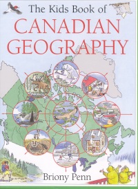
Highly engaging and appealing, this book is the latest in the Canadian "Kids Book of..." series. The author hooks the reader instantly with the book's unique introduction comprised of 12 questions or clues about different parts of Canada. Each of the answers is directly related to one of Canada's varied geographical features. There are six main chapters highlighting such topics as ancient landscapes (explaining how the country was formed millions of years ago), climate and how it affects everything in the landscape, and continent shaping, which covers erosion, weathering and the effects of the Ice Age. The chapter entitled "Life on the Land" discusses evolving ecosystems and the creation of the eight principal geographical areas of Canada as well as the influence of the first peoples and the Europeans on culture, industry, exploration, settlement and even the place names of towns and cities. "Regional Ecosystems," the final chapter, takes readers on a tour of the eight geographical regions- the tundra, boreal forest, Laurentian woodlands, coastal rain forest, western Cordillera, prairie, Acadian woodlands and the Carolinian woodlands (the latter being a relatively new term for most students). Each of these regions is explained using identical subheadings: the ancient landscape, climate, plants and animals, first peoples, new arrivals and the landscape today. A page entitled "Decoding Your Landscape" follows the information about each region and poses several questions. One example, taken from the section about the tundra, asks "What takes a minute to create and centuries to repair in the Arctic?" From the answer - vehicle tracks and garbage dumps - and the subsequent explanation, readers will learn about the fragility of the tundra ecosystem. Well-written, with more difficult concepts explained in a step-by-step fashion, the text, along with abundant maps, diagrams and drawings rendered in watercolour and ink, sustains the reader's interest throughout the book. A table of contents and an index are included. Highly Recommended. Gail Hamilton is a teacher-librarian in Winnipeg, MB.
To comment
on this title or this review, send mail to cm@umanitoba.ca.
Copyright © the Manitoba Library Association. Reproduction for personal
use is permitted only if this copyright notice is maintained. Any
other reproduction is prohibited without permission.
NEXT REVIEW |
TABLE OF CONTENTS FOR THIS ISSUE
- October 24, 2008.
AUTHORS |
TITLES |
MEDIA REVIEWS |
PROFILES |
BACK ISSUES |
SEARCH |
CMARCHIVE |
HOME |